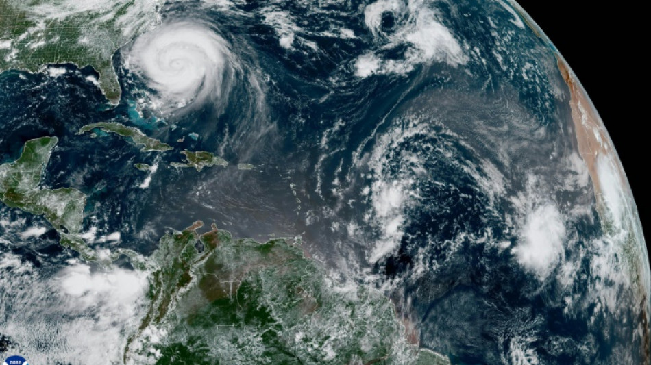
North Carolina coasts prepare for flooding as Erin churns offshore / Photo: © NOAA/AFP


Hurricane Erin threatened North Carolina's coast Wednesday with huge waves and flooding, as the strengthening Category 2 storm triggered mandatory evacuation orders despite its offshore path.
The US state, still reeling from last year's deadly Hurricane Helene, declared an emergency Tuesday as Erin's worst impacts were predicted to begin from Wednesday evening through Thursday.
"Based on the current forecast, we are anticipating coastal flooding from massive waves, tropical storm force winds and tidal and storm surge for much of the state shoreline, especially the Outer Banks, from this evening through Thursday," Governor Josh Stein told reporters.
As of Wednesday morning, Erin was churning northward some 350 miles southeast of North Carolina, packing maximum sustained winds of 110 mph (175 kph), according to an update by the National Hurricane Center -- with additional intensification likely over the next day or so.
Its unusually large size means tropical-storm-force winds extend hundreds of miles from its center.
Additional states of emergency have been declared in three North Carolina counties, with mandatory evacuation orders for Ocracoke and Hatteras Islands. A tropical storm warning has been issued across parts of North Carolina to Virginia.
Stein urged residents to heed local warnings and pack disaster bags with enough food, water and supplies to last up to five days -- and to safeguard important documents like their insurance policies.
"We have already pre-positioned three swift water rescue teams and 200 National Guard troops to various locations on the coast, along with boats, high clearance vehicles and aircraft," he added.
- 'Massive' waves -
Highway 12 -- which runs through the scenic Outer Banks, a string of low-lying islands and spits already under threat from sea-level rise and erosion -- could be left impassable by waves that reach as high as 20 feet.
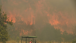
Last year's Hurricane Helene caused approximately $60 billion worth of damage to North Carolina, equivalent to almost two-year's worth of the state's budget, said Stein, who criticized what he called inadequate federal assistance from the administration of President Donald Trump.
Trump has mused about dismantling the Federal Emergency Management Agency, which has long been a target of conspiracy theories from the political right.
"This one appears to be localizing on North Carolina, but many of the storms hit an entire region. The scale of these storms are massive," Stein said, adding it was essential "that we keep and improve FEMA."
Beyond the flooding risks focused on North Carolina, nearly the whole of the US East Coast meanwhile is threatened by rip currents, powerful surges that run against the tide.
- Insurance risks -
The Atlantic hurricane season, which runs from June 1 to November 30, has entered its historical peak.
Despite a relatively quiet start with just four named storms so far, the National Oceanic and Atmospheric Administration continues to forecast an above-normal season.
Scientists say that climate change is supercharging tropical cyclones: warmer oceans fuel stronger winds, a warmer atmosphere intensifies rainfall, and higher sea levels magnify storm surge.
There is also some evidence, though less certainty, that climate change is making hurricanes more frequent.
Federal Reserve Chair Jerome Powell recently warned that climate change will shrink mortgage availability across swaths of the United States in the coming years as banks and insurers retreat from fire- and flood-prone regions.
Z.Hall--VC